
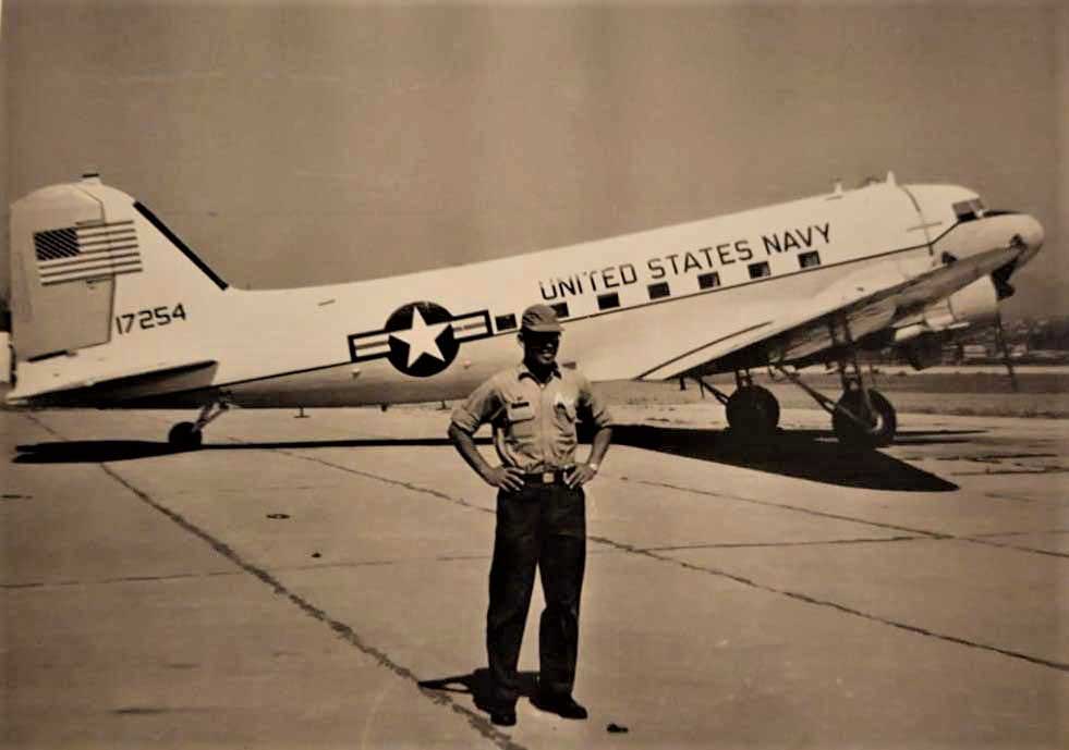
This C-47 aircraft was assigned to the US Military Group – Navy Section, Chile. It was enroute from its home base at El Belloto Naval Air Station near Vino del Mar, Chile to Buenos Aires, Argentina, with a stop at Los Cerrillos airport in Santiago for the necessary international clearance. It departed Los Cerrillos at 2050Z (1650/4:50 PM) on 04 Aug 1969 for Buenos Aires. There were 4 crewmembers and 12 passengers aboard. The passengers were US Navy and US Air Force personnel and some of their dependents.
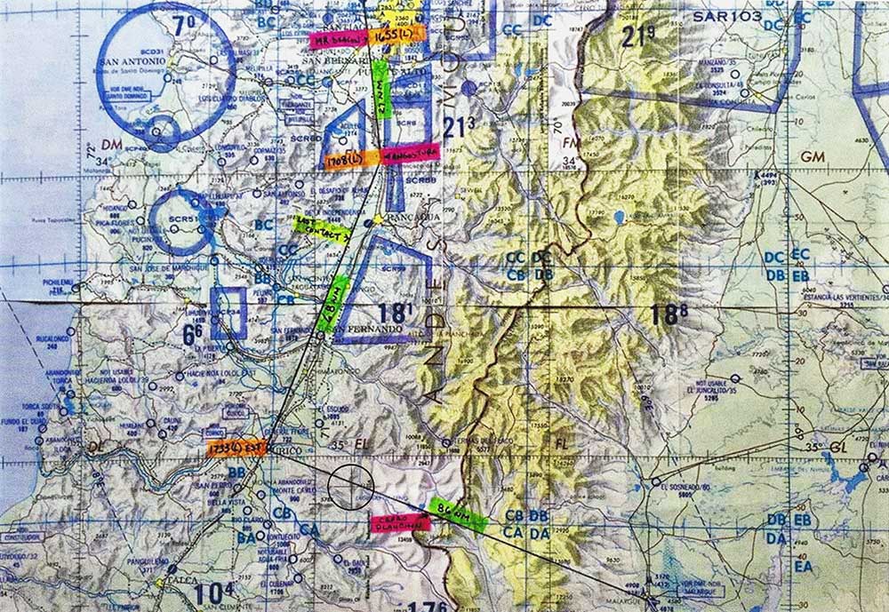
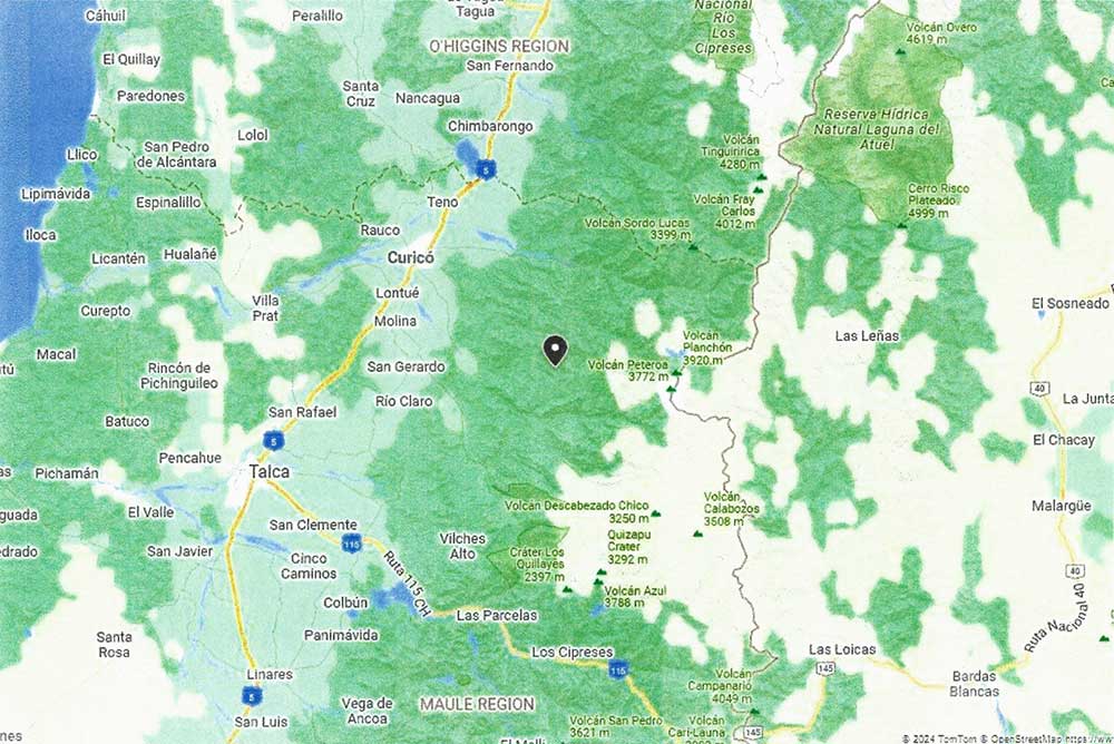
The pilot, CDR Ralph J. Touch, started filling the Flight Plan form, but there was some uncertainty as to whether to file IFR or VFR. The co-pilot, LCDR James P. Kuhn, continued filling the form and signed it and filed IFR. The Flight Plan was approved by Pudahuel Air Traffic Control (ATC) and the chosen route was for the aircraft to fly S to Curico, then SE to Cerro Planchon (mountain pass on Chile-Argentina border), then continuing SE to Malargue and then NE to Buenos Aires. The pilot was to fly at 12,000 ft. altitude until Curico, then climb to 17,000 ft.
Weather conditions were bad, with snow, moderate turbulence up to 14,000 ft. altitude, severe turbulence above 14,000 ft. and ice formation at 5,000 ft. Wind was from the WNW at 20 knots (approx. 23 mph) below 14,000 ft. Above that altitude, the winds were 50 knots (approx. 58 mph) and possibly up to 100 knots (approx. 115 mph) to over 20,000 ft. Chief of Meteorological Station at Los Cerrillos Airport warned CDR Touch to return to Santiago if the Cordillera (Andes Mountains) was closed because of bad weather. CDR Touch answered: “No, because already I am one day late”. Note that this flight was originally planned to depart on 03 Aug, but was delayed because of bad weather.
The aircraft reported over Angostura at 1707, flying at 12,000 ft. and estimated to reach Curico at 1733. One minute after the aircraft communicated this position, the ATC overheard part of a conversation over an open microphone in which the co-pilot was recommending to the pilot that they start climbing to a 14,000 ft. level to avoid bad weather ahead. At 1715, Santiago Center contacted the aircraft to confirm its altitude, and the aircraft acknowledged it was at 12,000 ft. This was the last contact with the aircraft. One minute later, an open microphone was heard from the aircraft for a few seconds, without sound of voice. All further contact with the aircraft was lost.
The US Navy search for this missing aircraft spanned only 10 days, from 05 Aug 1969 to 14 Aug 1969, and was never resumed. The search was hampered by 3 to 4 meters of fresh snow, rugged terrain and severe weather conditions. A total of 162 missions with nearly 1,000 hours were flown. 972 persons assisted in the search effort, involving personnel and aircraft from the US, Chile and Argentina. The 1969 search area was divided into 5 zones, with the search concentrated in Zones 2 and 3, to the N of Curico. The USN official conclusion stated the accident was a result of poor weather conditions: “Atmospheric conditions on the Santiago – Curico – Malargue route were such that a flight was not advisable, especially for a C-47 aircraft with limited capability for crossing the Andes Mountains, and even more so if it’s considered that the minimum flight altitude on the Curico – Malargue route is 16,000 ft. and it was icing at 5,000 ft.” Dead: 16
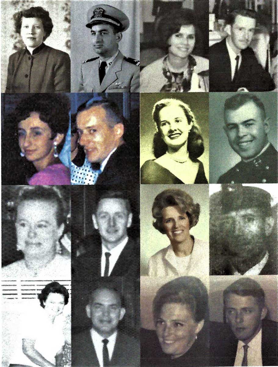
- Pilot: CDR Ralph J. Touch, USN
- Co-Pilot: LCDR James P. Kuhn, USN
- Radioman: ATC Joe Fernandez, USN
- Aircraft Mechanic: ADRC John T. Higgins, USN
- Passenger: LCDR Harold L. Mooney, USN
- Passenger: TSgt. Robert L. Patterson, Jr., USAF
- Passenger: SSgt. Ronnie J. Ball, USAF
- Passenger: SSgt. Frank A. Homer, USAF
- Passenger: Norma R. Orcutt Ball, Civilian dependent
- Passenger: Claudine Cox Fernandez, Civilian dependent
- Passenger: Carol Homer, Civilian dependent
- Passenger: Shelby Penn Mooney, Civilian dependent
- Passenger: Esther Zuluaga Patterson, Civilian dependent
- Passenger: Elisabeth/Elizabeth Anne Smith, Civilian dependent
- Passenger: Carol Tilton, Civilian dependent
- Passenger: Norma Ann Heist Touch, Civilian dependent
Note: Some of the passengers aboard this aircraft were intelligence officers assigned to the US Embassy in Santiago, Chile. The aircraft crashed during a period when the US government of President Richard Nixon and the CIA were concerned about the possible takeover of the Chilean government by the Marxist political party of Salvador Allende. Nixon and his CIA wanted to prevent any further Russian influence in the Western Hemisphere, and Secretary of State Henry Kissinger lead the US effort to thwart Allende and his Marxists. Allende was ultimately elected President of Chile, but was soon assassinated in a rightwing military coup staged by General Augusto Pinochet. It is entirely possible that the pilot of BuNo 17254 was anxious to depart Chile, despite the bad weather and warnings to delay his flight, because the intelligence officers aboard his aircraft were in imminent danger of being detained by the Chilean government.
View the Crashed Aircraft Site Report (PDF)
View Discussion of Crash Site Location (PDF)
C-47B #43-48368 a.k.a. BuNo 17254 Photo Gallery
Click on any image for a larger view


C-47B #43-48368 a.k.a. BuNo 17254 Notes
In 2019, I had been contacted by family members and aircraft accident researchers asking if I had any knowledge about this aircraft loss. I replied to them that I had done extensive mountaineering expeditions in the Andes Mountains along the Chile-Argentina border, but I didn’t have any specific knowledge about this aircraft disappearance.
Shortly thereafter, I learned that a relative of the C-47 co-pilot had led a search for the crash site, but he failed to find any aircraft wreckage or other definitive evidence about the wreckage location. This searcher was acting on his personal belief that the pilot had made a radical (and completely unauthorized) diversion from his approved flight path and had turned east towards the border range of mountains significantly north of his approved crossing point at Cerro Planchon.
I never subscribed to an unauthorized diversion from the approved flight path because the archival records clearly show that the pilot was repeatedly warned by his commanding officer prior to departure not to take any unnecessary risks that might jeopardize the safety of the passengers. This belief of mine was further reinforced when I had the incredible good fortune of meeting the pilot’s former commanding officer in the USN, and the former naval commander stated that Ralph Touch was one of his best pilots and was regarded as being very competent, conservative, cautious and averse to taking any unneeded risks.. he always followed the rules and wasn’t a rebel or rule-breaker in any manner.
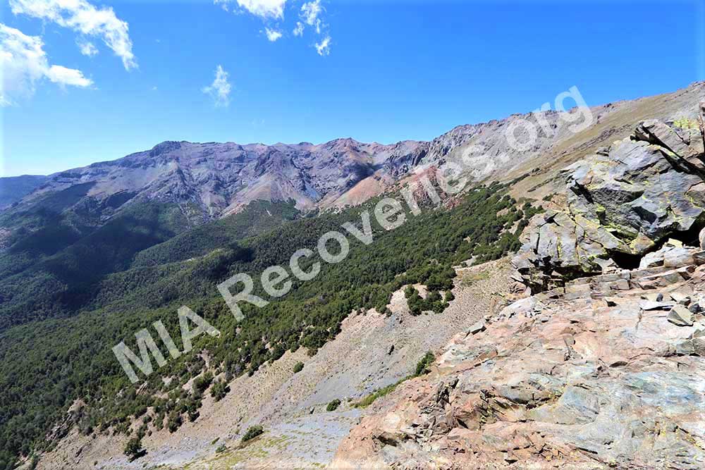
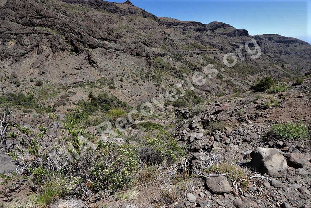
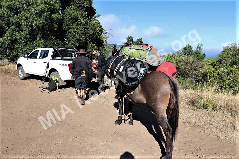
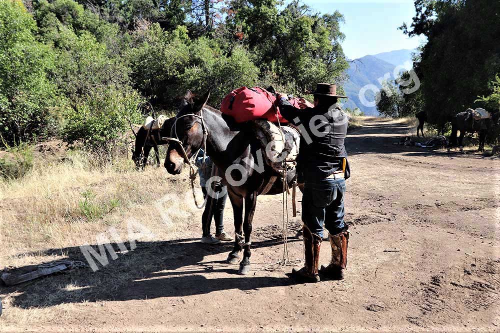
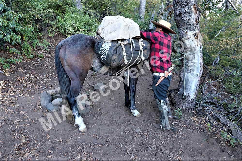
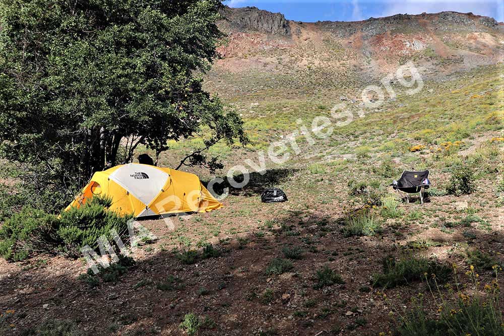
My team and I had spent weeks investigating possible crash locations along the flight path, when we came down from the mountains for a rest and checked into a rental cabin in the village of Los Quenes in Del Mauli district. The proprietor of the rental cabins expressed great interest in who we were and why we were there. She then said her brother might have valuable information for us and she would have him visit us the following day.
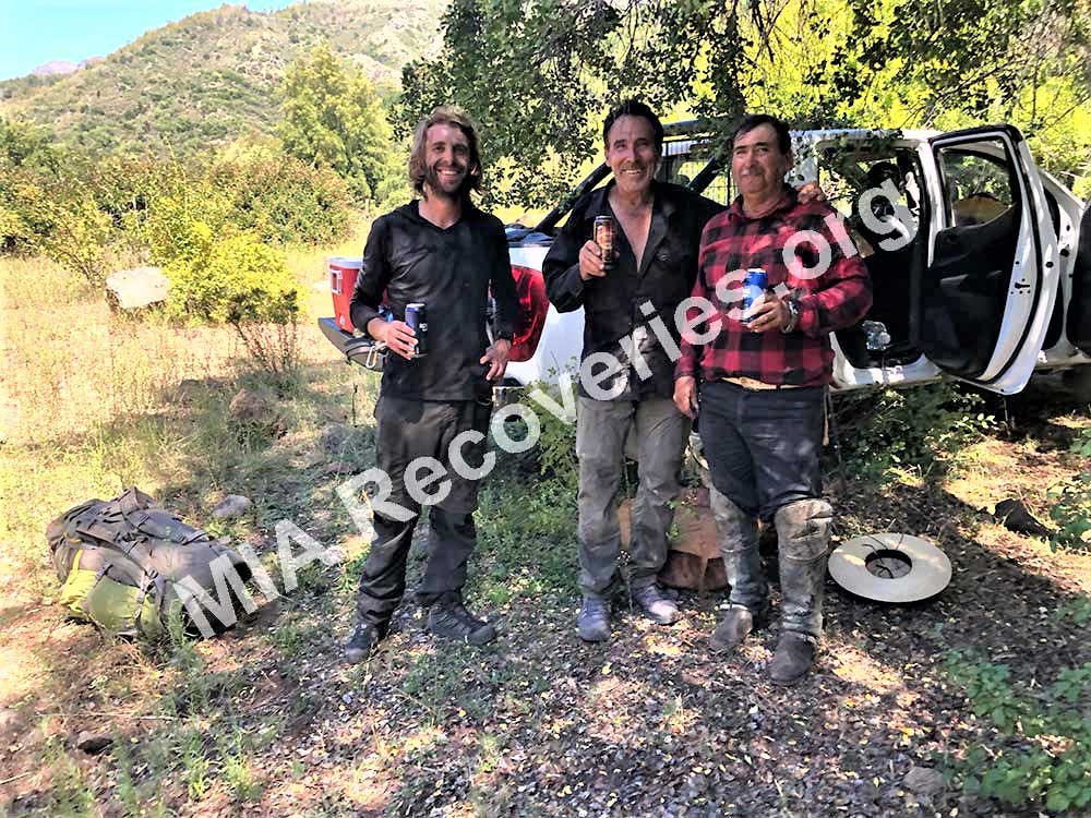
The proprietor’s brother arrived at our rented cabin the following morning and told us he knew an old rancher in the town who sometimes talked about finding an aircraft wreckage in the mountains years ago while herding horses. We had this man take us to the old rancher and assist us with interviewing him. The rancher stated he came across the aircraft wreckage in the early 1970’s (probably in 1970 or 1971) while searching for a water source. He said the wreckage wasn’t there in the mid-1960’s when he last herded horses in the area. He said he was now too old and infirm to return to the mountains, but he would arrange for a younger rancher to guide us to the wreckage.
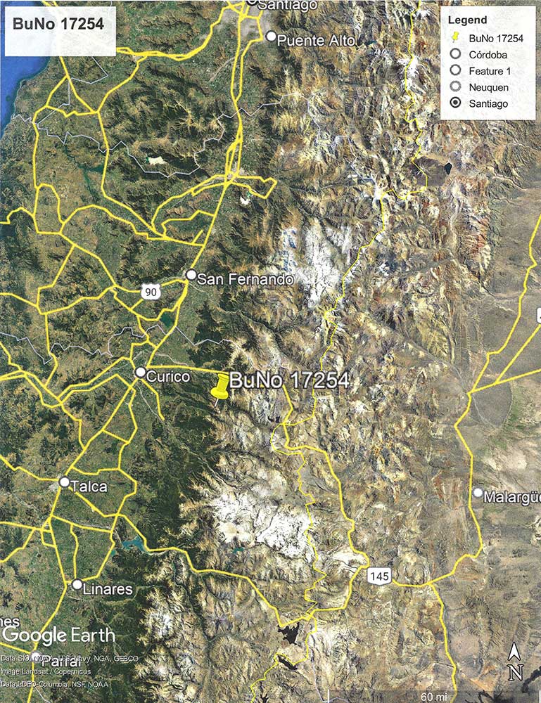
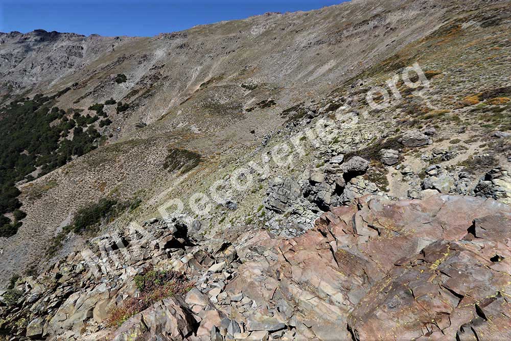
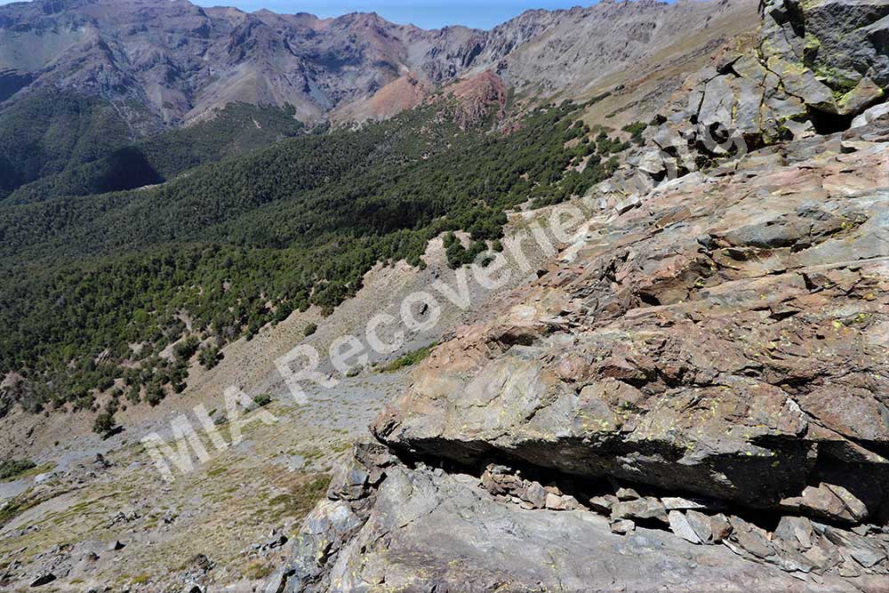
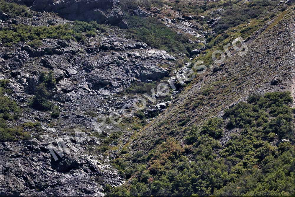
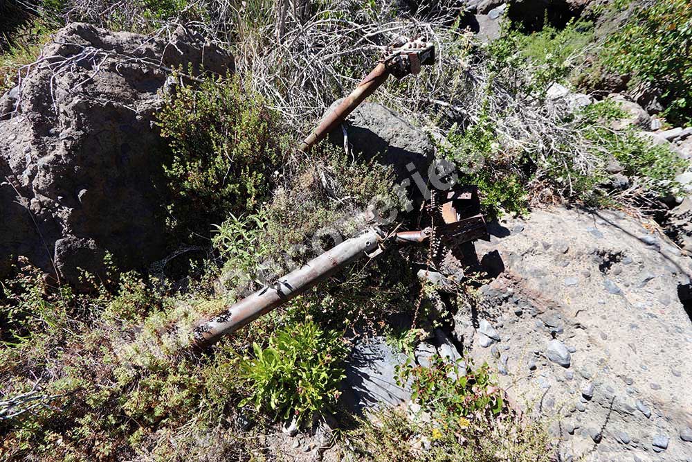
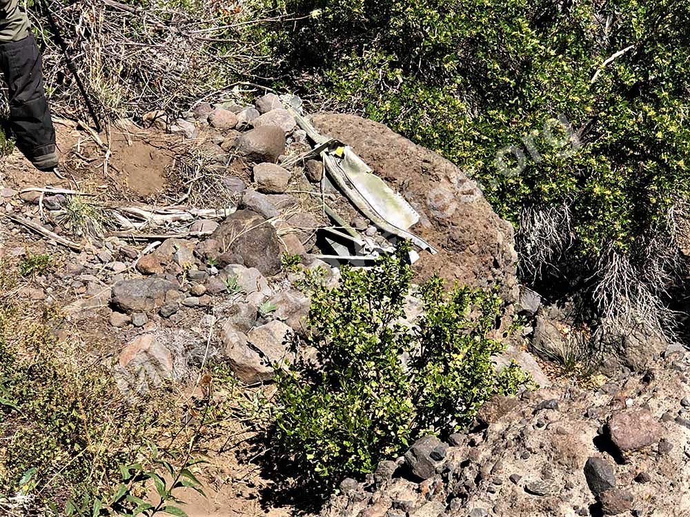
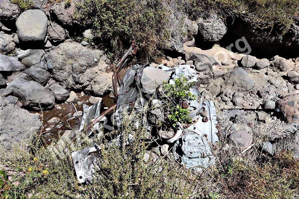
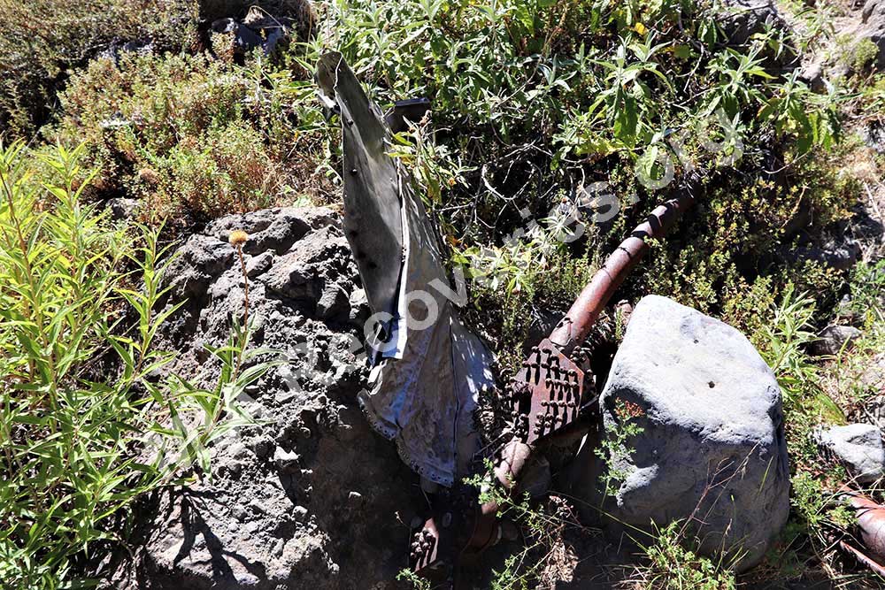
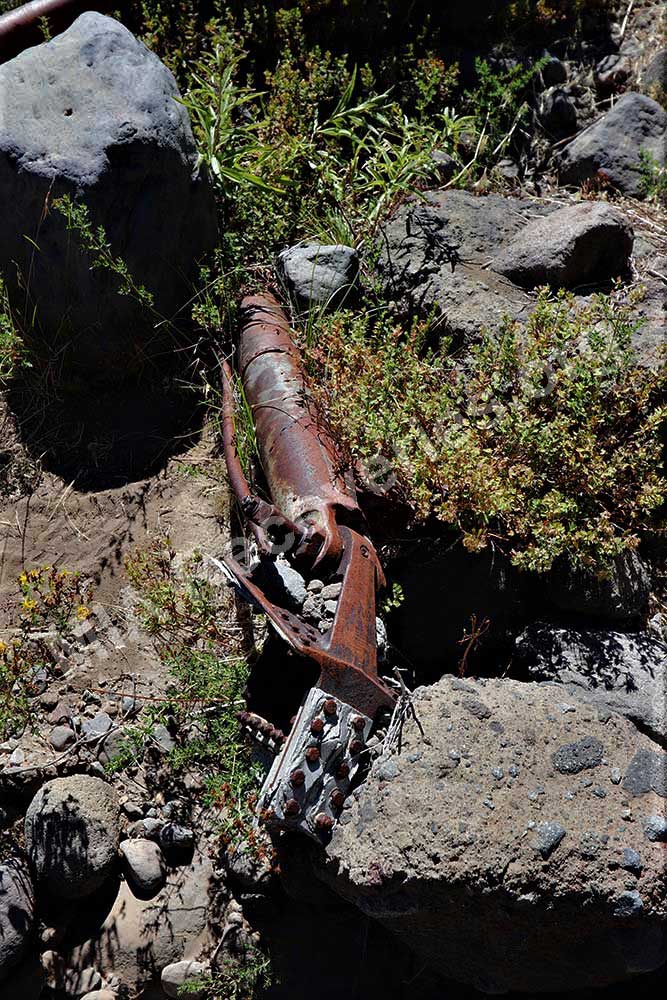
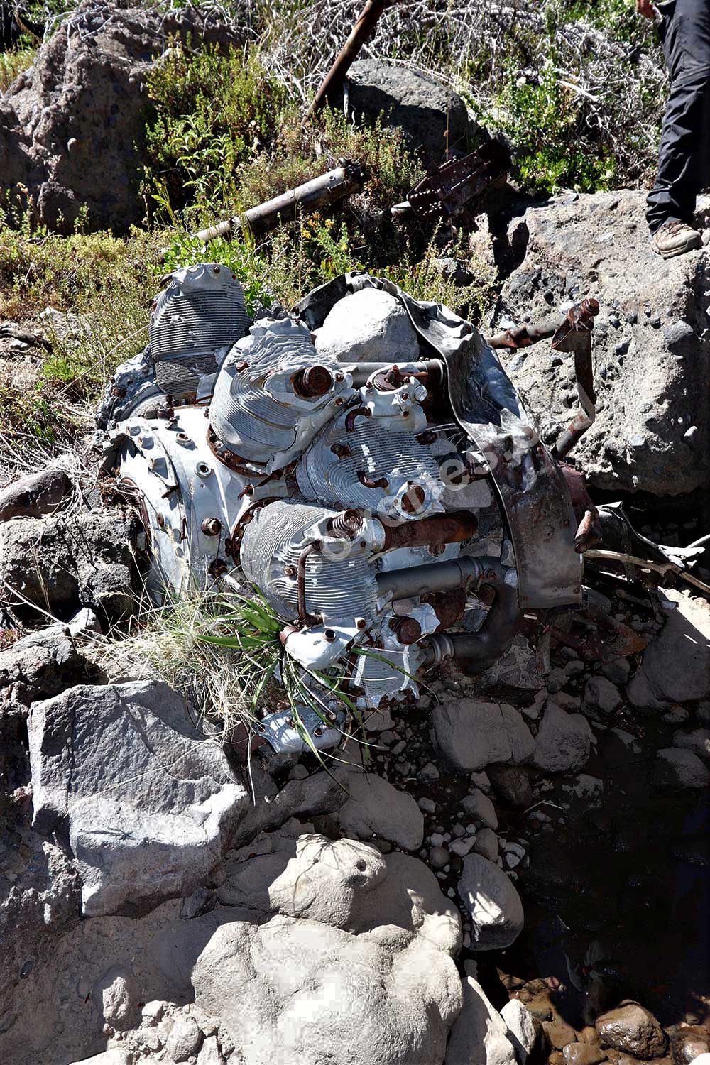
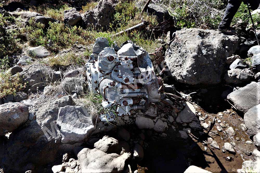
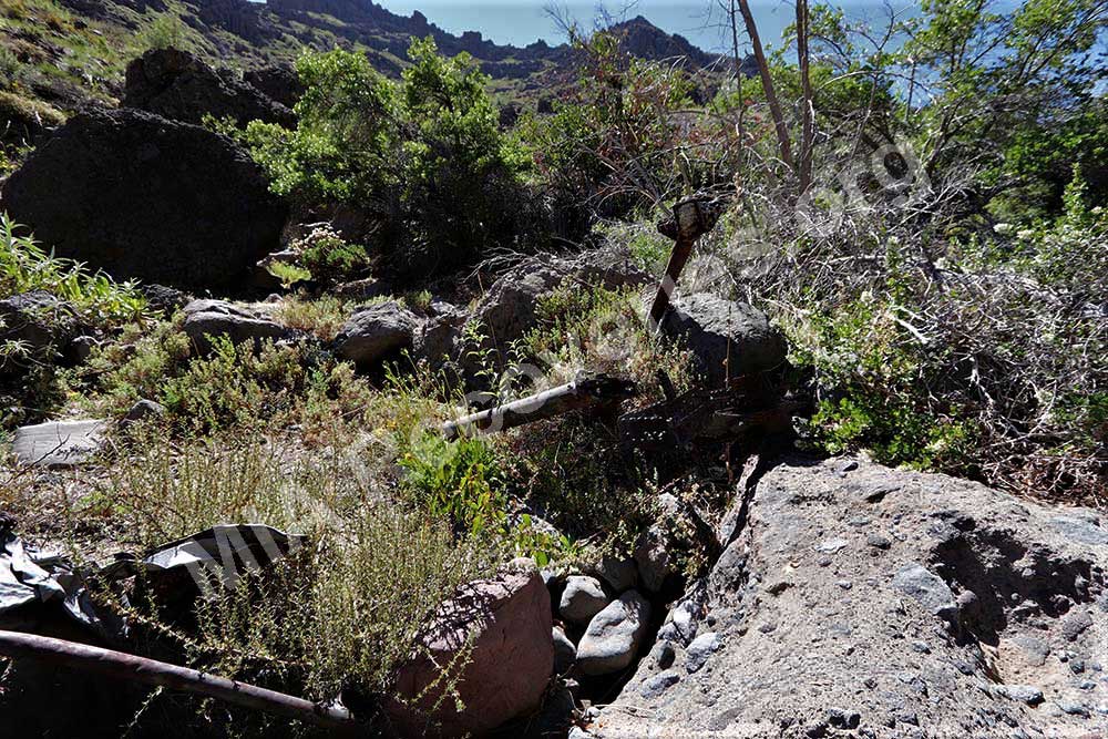
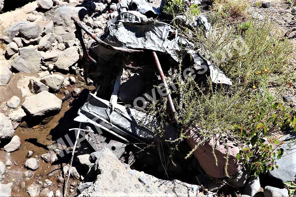
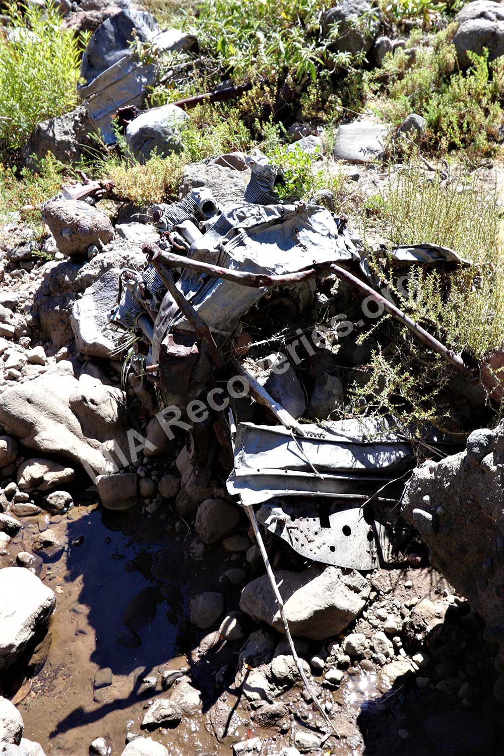
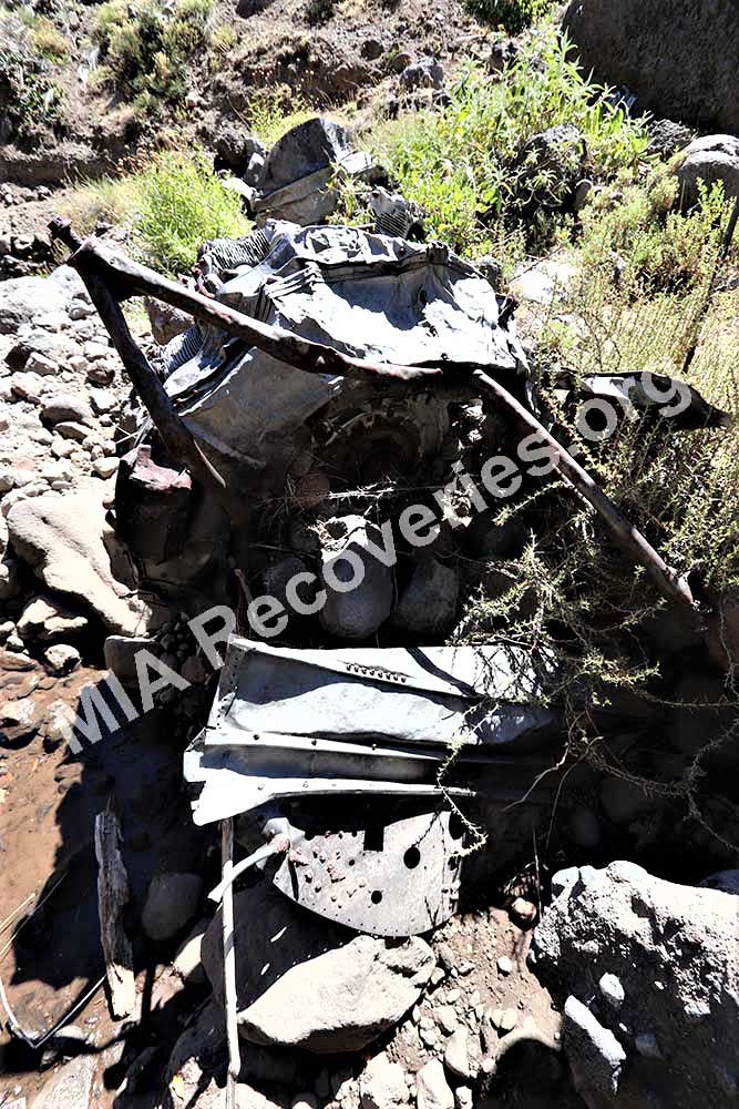
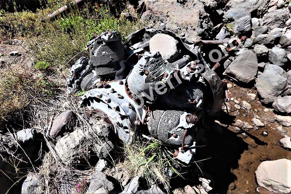
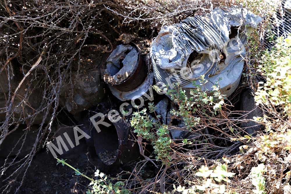
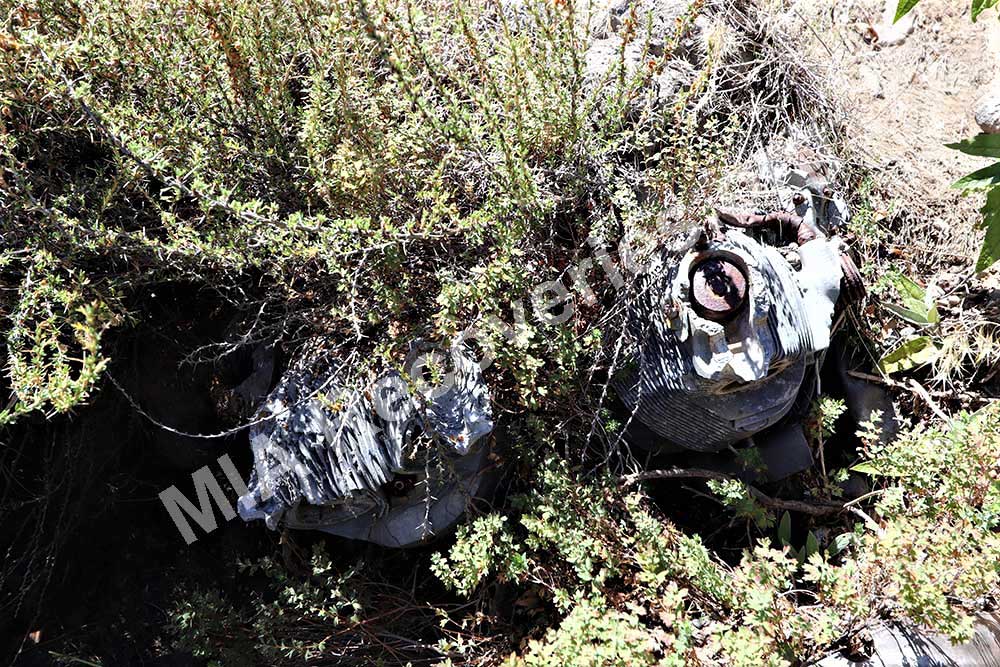
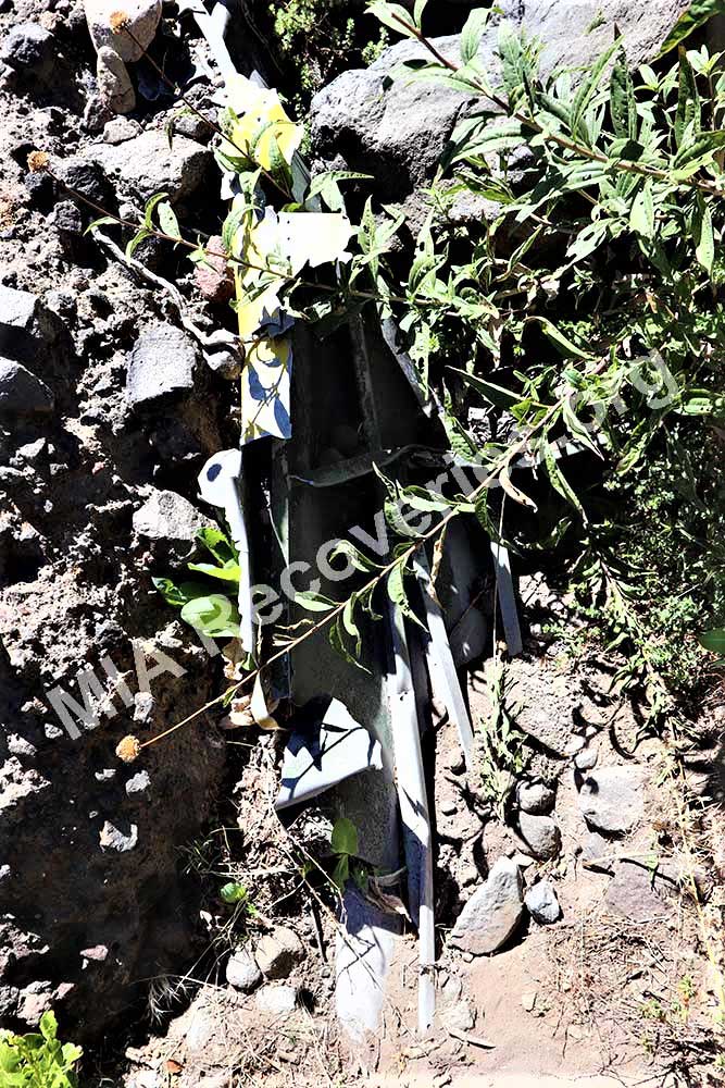
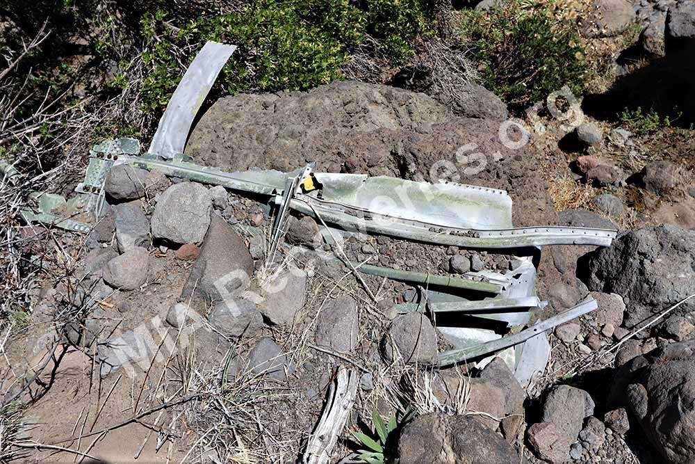
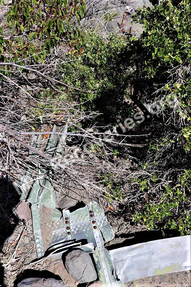
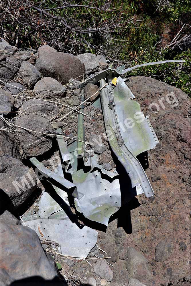
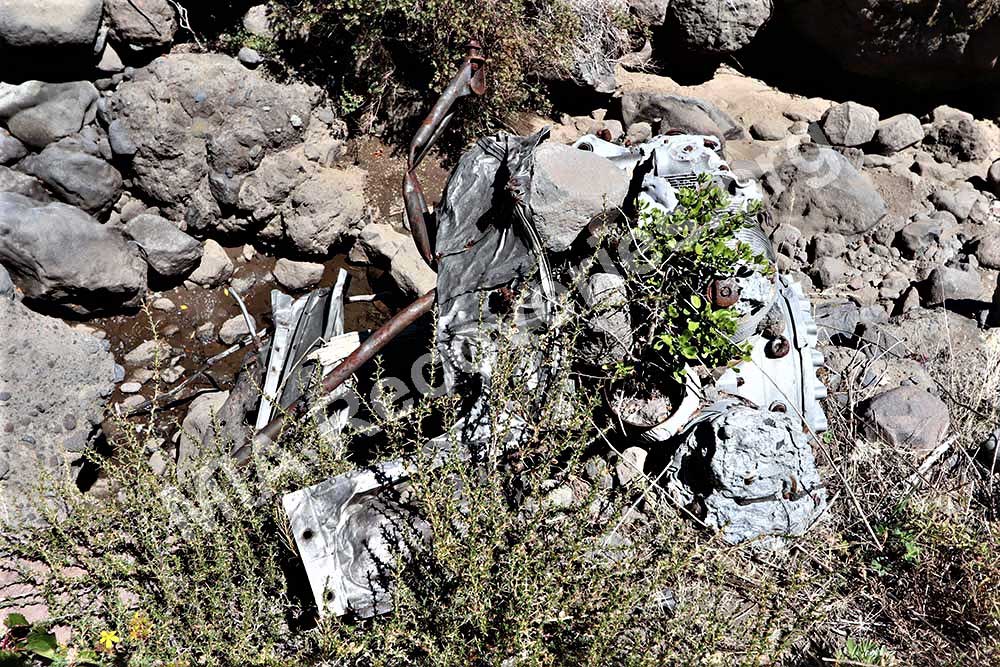
With the capable guidance of the younger rancher and his team of pack animals, we reached the wreckage location a few days later. The aircraft ID was positively established when we found a metal panel amongst the wreckage bearing the aircraft construction number of 14184. The wreckage location was indeed on the approved flight path for BuNo 17254 and was blown just slightly off-course by the prevailing WNW winds recorded for the day of the crash. We later confirmed with the Chilean aviation authorities that they were unaware of any reported aircraft wreckages in this area, making this a new discovery. Furthermore, the Chileans stated that all known C-47 losses over Chile had since been located, with the sole exception of BuNo 17254 (until now).
To the best of my knowledge, the US Dept of Defense has not yet sent a team to the crash site. This might be due to the election of an anti-US, leftist national government in Chile shortly after my discovery of the crash site.
These notes were prepared by Clayton Kuhles, founder and president of MIA Recoveries, Inc.